Season by season
December–February
Winter is best treated as a ski season rather than a reliably pleasant urban-break season. Storms, snow and black ice can complicate driving; valley temperature inversions can trap unhealthy pollution even while the mountain air is clear.
Driving is least forgiving, and poor air can spoil valley views and outdoor time. Ski weekends can also tighten lodging and worsen traffic.
March–May
A changeable shoulder season: conditions can swing sharply between warm and cold. Late spring is one of the better windows for walkable city weather and for access to mountain roads and trails.
Do not assume stable spring weather or fully dependable mountain access; cold snaps and late-season snow remain possible.
June–August
Summer is long, hot and very dry. It is workable for outdoor plans if you start early and use the mountains or shaded indoor stops during the hottest part of the day.
All-day pavement wandering is uncomfortable in the heat, and water and sun protection are essential. Late July also brings Pioneer Day activity and associated crowd/traffic pressure.
September–November
Early fall is the other standout window: generally the best balance of walkable weather and access to mountain roads and trails. Conditions become more variable as winter approaches.
Fall can turn warm or cold quickly, and later in the season mountain weather and road conditions become less dependable. Major University of Utah sports or concert dates can worsen traffic and lodging availability.
Events worth planning around
Pioneer Day · Around July 24 each year
Late-July celebrations materially increase activity around the holiday; expect more crowds and traffic, and avoid treating it as an ordinary quiet summer weekday.
Getting around
Walking
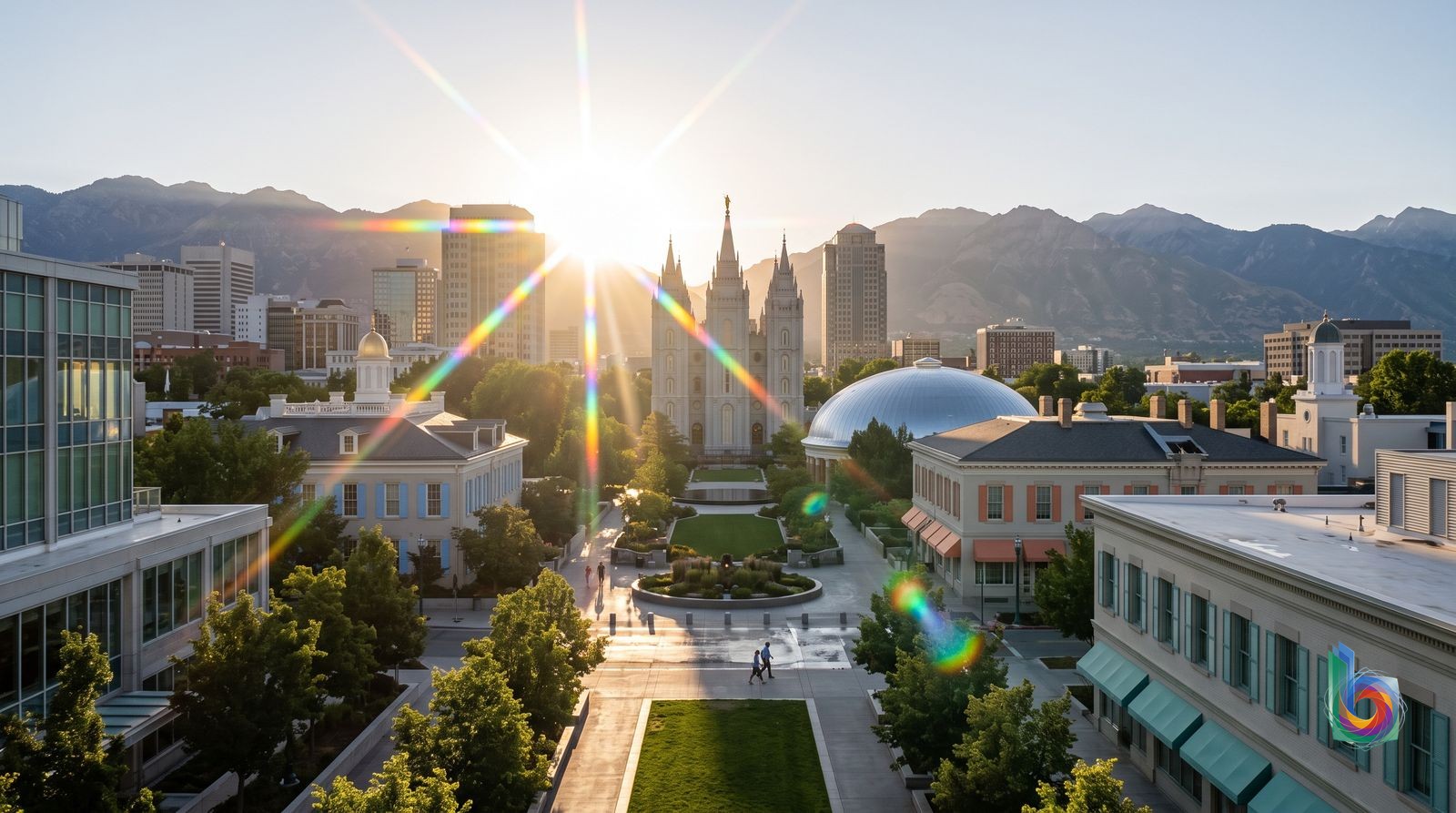
Downtown & Temple Square is compact enough for a serious walking day: Temple Square, City Creek, the Main Library/City & County Building area, Clark Planetarium and much of the central hotel zone. It is also the best way to understand Salt Lake’s coordinate grid.
Save addresses with their full cardinal direction—500 East and 500 West are entirely different streets. Use Temple Square as the grid’s zero point, and plan fewer stops than the map suggests: blocks are wide and the best outdoor scenery is outside the core.
Walking stops being effortless in the Avenues, Capitol Hill, University & Fort Douglas, and East Bench & Foothill, where the uphill grades and altitude matter. Sugar House and 9th & 9th are not casual walks from Temple Square; in summer heat, winter ice, or after dark around Pioneer Park and some west-downtown blocks, choose another mode.
UTA TRAX light rail
The best car-free spine for airport-to-downtown travel, downtown hotels and sights, the Gateway, Central Ninth, and the University of Utah. The Green Line is the sensible Airport Station-to-city-center transfer—about 20 minutes—and the Red Line makes the University straightforward.
Buy and validate a UTA fare before boarding; use the UTA app or station ticket machines. For the airport trip, the stored guidance puts the one-way fare at roughly $2.50. Base yourself downtown if you expect to use TRAX repeatedly: it is the city’s most plug-and-play transit area.
TRAX is not a dense metro. It does not solve the last mile in Sugar House, 9th & 9th, the Avenues, Capitol Hill, East Bench & Foothill, Glendale, or much of the Granary District. Even at the University, campus distances and uphill attractions add up; late-evening service and connections need checking rather than assuming.
UTA buses
The necessary fill-in for neighborhoods beyond the rail corridors: the Avenues, Capitol Hill, 9th & 9th/Liberty Wells, Foothill Boulevard and Glendale. It is the practical low-cost option when a direct route matches your address and schedule.
Plan the exact trip in UTA’s app or a live transit map, not just a static map; bus usefulness is route- and timing-specific. Keep the full street address, including N/S/E/W, in your navigation app. Treat it as a planned trip, especially for the International Peace Gardens or the foothill neighborhoods.
Buses are weaker for spontaneous, late-night movement and cross-town hops. Glendale and the west side have larger distances and less effortless connections; East Bench & Foothill is spread out and hilly; the Avenues and Capitol Hill still leave you with steep walks. Do not choose Sugar House or 9th & 9th as a transit-only base if you expect easy late dinners downtown.
S-Line streetcar
A useful local link for Sugar House stays and wandering around its commercial center and park, connecting Sugar House to Central Pointe for TRAX transfers.
Use it as part of a two-stage trip—S-Line to Central Pointe, then TRAX—not as a direct downtown train. Check the live schedule before an evening out and pair it with walking or a bus for the final few blocks.
It is short and indirect for major sights: Temple Square is not an easy one-seat ride or walk from Sugar House. It is a poor answer to late-night plans, scattered lodging, or the traffic-heavy, parking-oriented edges of the district.
Rideshare or taxi
The sensible convenience tool for dispersed restaurants, trailheads, Sugar House or 9th & 9th evenings, the uphill return to the Avenues or Capitol Hill, and gaps after transit becomes inconvenient. It is also reasonable from the airport for late arrivals, ski gear, or hotels far from TRAX.
Use the app for point-to-point trips rather than defaulting to a car rental. Set pickup points carefully at large venues and downtown hotels, and check the full address with its cardinal directions. For an airport arrival during normal rail hours, take the Green Line instead.
Fares rise quickly and can surge around University of Utah games, concerts, ski weekends and late nights. It does not make remote attractions cheap or easy: trailheads, Antelope Island, the Salt Flats and canyon hiking are car trips, not routine rideshare territory.
Rental car or personal car
Worth having for a deliberately outdoors-led itinerary: canyon hiking, Antelope Island, Bonneville Salt Flats, or Park City. It also makes East Bench & Foothill and Glendale materially easier, and is useful for visitors carrying outdoor equipment or traveling as a family.
Skip it for a short downtown-focused stay; downtown plus TRAX and occasional rideshare is easier and avoids parking. If you do rent, choose one only for the days you leave the city. Keep bags and ski gear out of sight in parked vehicles.
A car is more burden than benefit in Downtown & Temple Square, Gateway event traffic, and compact central sightseeing. Winter black ice, snowstorms and canyon conditions make casual driving a bad bet; mountain weather is separate from valley weather. Antelope Island is closer to 1–1½ hours each way once the causeway is factored in, and the Salt Flats are roughly two hours each way—these are full outings, not quick detours.
Safety: Downtown is generally straightforward by day, but keep bags and ski gear out of parked cars, avoid lingering around Pioneer Park after dark, and check canyon road, avalanche and winter-driving conditions before heading into the mountains.
- No ordinary sightseeing attraction in Salt Lake City reliably requires booking before you land. Temple Square, the Utah State Capitol and many of the best central stops are free. Book ahead only for a specific concert, Utah game, ski day, or a timed special exhibition; standard museum and zoo admission is usually a same-day decision.
- Temple Square is worth seeing as architecture and as the city’s historical center, but the Salt Lake Temple itself is not open to general visitors: entry requires an LDS temple recommend. Missionary-led tours and public spaces are open to non-members; a polite ‘no thanks’ is enough if you do not want a longer conversation.
- Use the grid. ‘500 East’ and ‘500 West’ are different streets, and cardinal words in a street name are coordinates rather than a promise of the direction traffic travels. Save addresses exactly, including North/South/East/West.
- Free, genuinely worthwhile core itinerary: Temple Square and its public buildings; the State Capitol grounds and interior; the City & County Building and Main Library; Clark Planetarium’s free exhibits; and a walk in City Creek Canyon or Liberty Park. Check the library rooftop terrace status before going—it was closed for renovation in the supplied reporting.
- Property crime is a more realistic concern than random violence: keep bags and ski gear out of a parked car. Downtown is generally straightforward by day; avoid lingering around Pioneer Park after dark, and use normal city awareness in the west-side transit areas.
- For outdoors, treat the mountains as a separate weather zone. Bring water and sun protection in summer; in winter, check canyon road, avalanche and storm conditions before driving. If valley inversion pollution is bothering your lungs, heading uphill—not merely across town—is the practical escape.
Worth leaving the city for
Antelope Island State ParkFull day (roughly 5–7 hours door to door by car).
This is the Great Salt Lake experience worth having: broad saltwater views, bison, pronghorn and a landscape that makes downtown’s mountain-and-desert setting finally make sense. Go with a car, bring water, and accept bugs can be vicious in warm weather; it is not a polished lakeside resort.
Park CityMost of a day (about 6–9 hours door to door; roughly a 40-minute drive each way in clear conditions).
A genuine change of scene rather than another Salt Lake neighborhood: former mining-town Main Street, mountain terrain and Olympic-era ski infrastructure. It is particularly worthwhile for skiing, hiking or mountain biking; without an outdoor plan, the touristy core can feel overbuilt and expensive.
Big Cottonwood Canyon — Brighton or SolitudeHalf day in summer; full day for skiing (allow roughly 5–9 hours door to door).
Choose this over city sightseeing when the point of the trip is Utah’s Wasatch terrain: ski at Brighton or Solitude in winter, or hike in summer. It is close enough to be a half-day escape, but weather, canyon traffic and winter road conditions can turn that into a longer commitment.
Little Cottonwood Canyon — Snowbird and AltaHalf day for a scenic summer outing; full day in winter (roughly 5–9 hours door to door).
The more dramatic canyon option, with Snowbird’s year-round, weather-dependent tram to Hidden Peak and serious winter skiing around Snowbird and Alta. It beats a museum day for mountain scenery, but do not treat it as a casual drive after a snowstorm: canyon access and conditions dictate the day.
Bonneville Salt FlatsFull day (roughly 7–9 hours door to door by car, via the route toward Wendover).
The surreal, near-blank white expanse west of the city is unlike anything in Salt Lake proper and is the right call for photographers and anyone interested in land-speed-record history. It is a drive for one landscape, not a destination packed with activities; check conditions before expecting a mirror-like surface.
Golden Spike National Historical ParkFull day (roughly 7–9 hours door to door by car).
For railroad and western-history travelers, this is more substantial than another downtown pioneer-history stop: the site commemorates the 1869 joining of the transcontinental railroad. It is remote and best combined with the drive and open landscape, so skip it if history is not your thing.
Researched Oct 23, 2026